












10 Places to Visit Before you Die
10 PLACES TO VISIT BEFORE YOU DIE
9. Galapagos Island
Designed by Jeeyoung Jung
http://impressivemagazine.com/wp-content/uploads/2013/11/galapagos_islands_sunbathing.jpg
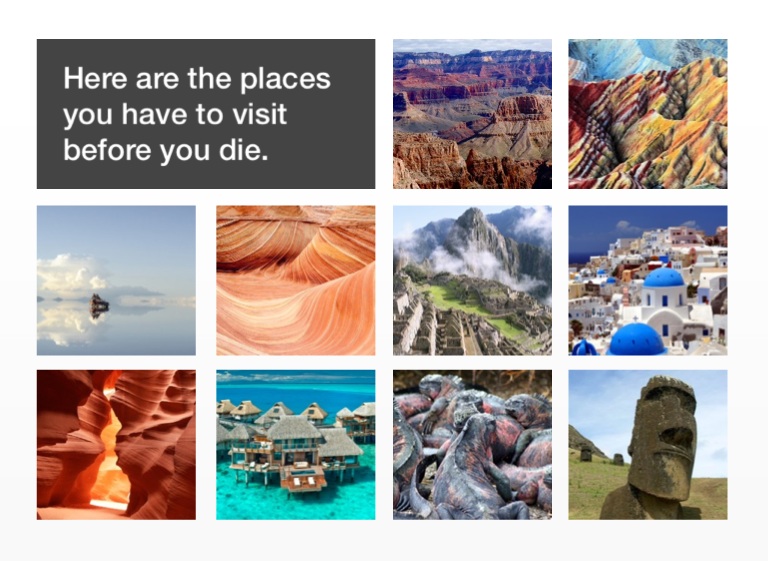
Here are the places you have to visit before you die.
1. Grand Canyon
http://www.creationscience.com/onlinebook/webpictures/hydroplateoverview-grand_canyon.jpg
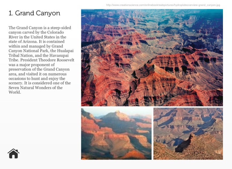
The Grand Canyon is a steep-sided canyon carved by the Colorado River in the United States in the state of Arizona. It is contained within and managed by Grand Canyon National Park, the Hualapai Tribal Nation, and the Havasupai Tribe. President Theodore Roosevelt was a major proponent of preservation of the Grand Canyon area, and visited it on numerous occasions to hunt and enjoy the scenery. It is considered one of the Seven Natural Wonders of the World.
2. Zhangye Danxia
http://sun-surfer.com/photos/2013/08/Colourful-rock-formations-in-the-Zhangye-Danxia-Landform-China.jpg
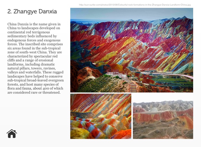
China Danxia is the name given in China to landscapes developed on continental red terrigenous sedimentary beds influenced by endogenous forces and exogenous forces. The inscribed site comprises six areas found in the sub-tropical zone of south-west China. They are characterized by spectacular red cliffs and a range of erosional landforms, including dramatic natural pillars, towers, ravines, valleys and waterfalls. These rugged landscapes have helped to conserve sub-tropical broad-leaved evergreen forests, and host many species of flora and fauna, about 400 of which are considered rare or threatened.
3. Salar De Uyuni
http://upload.wikimedia.org/wikipedia/commons/3/3e/Salar_uyuni_200701.jpg
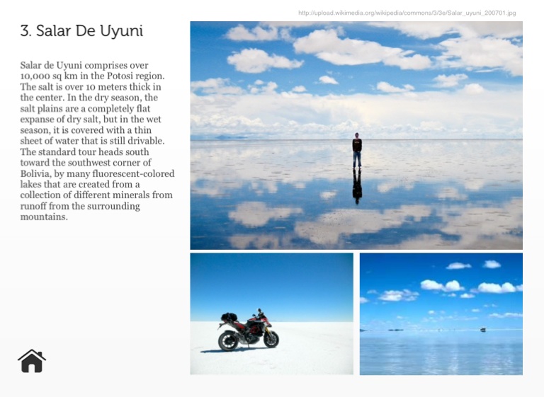
Salar de Uyuni comprises over 10,000 sq km in the Potosi region. The salt is over 10 meters thick in the center. In the dry season, the salt plains are a completely flat expanse of dry salt, but in the wet season, it is covered with a thin sheet of water that is still drivable. The standard tour heads south toward the southwest corner of Bolivia, by many fluorescent-colored lakes that are created from a collection of different minerals from runoff from the surrounding mountains.
4. The Wave
http://www.amazingplacesonearth.com/wp-content/uploads/2012/09/TheWave.jpg
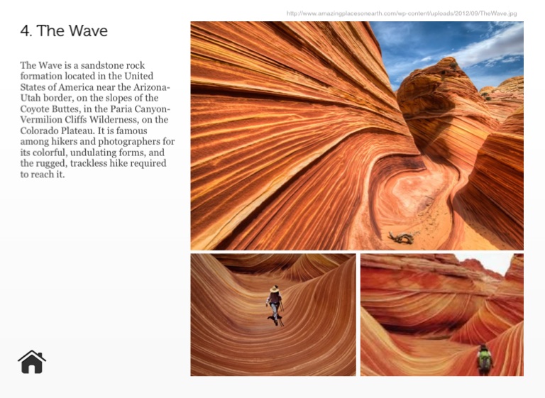
The Wave is a sandstone rock formation located in the United States of America near the Arizona-Utah border, on the slopes of the Coyote Buttes, in the Paria Canyon-Vermilion Cliffs Wilderness, on the Colorado Plateau. It is famous among hikers and photographers for its colorful, undulating forms, and the rugged, trackless hike required to reach it.
5. Machu Picchu
http://famouswonders.com/wp-content/gallery/machu-picchu/machu-picchu-late-afternoon.jpg
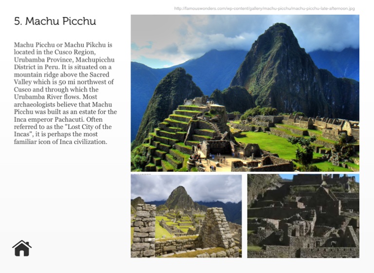
Machu Picchu or Machu Pikchu is located in the Cusco Region, Urubamba Province, Machupicchu District in Peru. It is situated on a mountain ridge above the Sacred Valley which is 50 mi northwest of Cusco and through which the Urubamba River flows. Most archaeologists believe that Machu Picchu was built as an estate for the Inca emperor Pachacuti. Often referred to as the "Lost City of the Incas", it is perhaps the most familiar icon of Inca civilization.
6. Santorini
http://static.travel.usnews.com/images/destinations/73/santorini_main.jpg
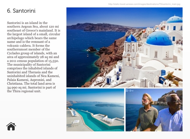
Santorini is an island in the southern Aegean Sea, about 120 mi southeast of Greece's mainland. It is the largest island of a small, circular archipelago which bears the same name and is the remnant of a volcanic caldera. It forms the southernmost member of the Cyclades group of islands, with an area of approximately 28 sq mi and a 2011 census population of 15,550. The municipality of Santorini comprises the inhabited islands of Santorini and Therasia and the uninhabited islands of Nea Kameni, Palaia Kameni, Aspronisi, and Christiana. The total land area is 34.990 sq mi. Santorini is part of the Thira regional unit.
7. Antelope Canyon
http://wallii.com/wp-content/uploads/2013/08/antelope-canyon-background.jpg
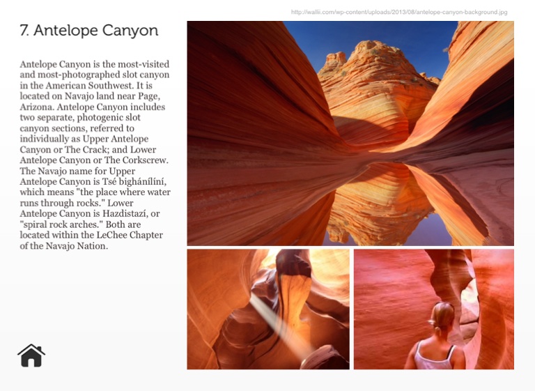
Antelope Canyon is the most-visited and most-photographed slot canyon in the American Southwest. It is located on Navajo land near Page, Arizona. Antelope Canyon includes two separate, photogenic slot canyon sections, referred to individually as Upper Antelope Canyon or The Crack; and Lower Antelope Canyon or The Corkscrew. The Navajo name for Upper Antelope Canyon is Tsé bighánílíní, which means "the place where water runs through rocks." Lower Antelope Canyon is Hazdistazí, or "spiral rock arches." Both are located within the LeChee Chapter of the Navajo Nation.
8. Bora Bora
http://0.tqn.com/d/create/1/0/w/k/8/-/Le-Meridien-Bora-Bora---Aerial.jpg
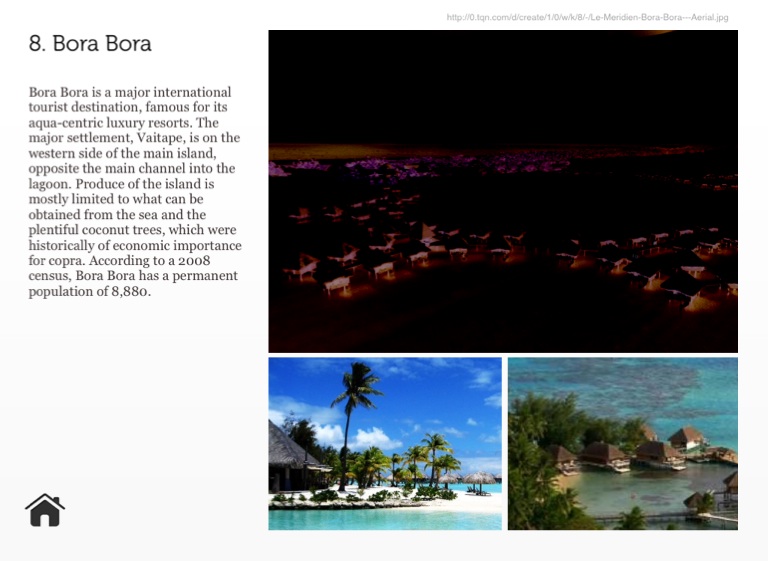
Bora Bora is a major international tourist destination, famous for its aqua-centric luxury resorts. The major settlement, Vaitape, is on the western side of the main island, opposite the main channel into the lagoon. Produce of the island is mostly limited to what can be obtained from the sea and the plentiful coconut trees, which were historically of economic importance for copra. According to a 2008 census, Bora Bora has a permanent population of 8,880.
9. Galapagos Island
http://impressivemagazine.com/wp-content/uploads/2013/11/galapagos_islands_sunbathing.jpg
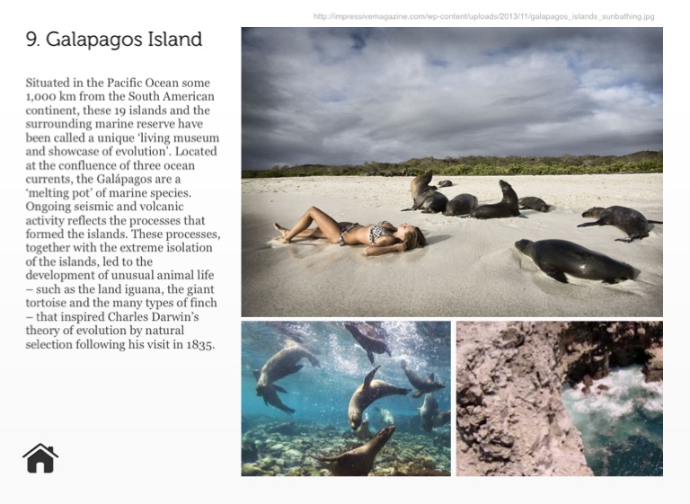
Situated in the Pacific Ocean some 1,000 km from the South American continent, these 19 islands and the surrounding marine reserve have been called a unique ‘living museum and showcase of evolution’. Located at the confluence of three ocean currents, the Galápagos are a ‘melting pot’ of marine species. Ongoing seismic and volcanic activity reflects the processes that formed the islands. These processes, together with the extreme isolation of the islands, led to the development of unusual animal life – such as the land iguana, the giant tortoise and the many types of finch – that inspired Charles Darwin’s theory of evolution by natural selection following his visit in 1835.
10. Easter Island
http://media-cdn.tripadvisor.com/media/photo-s/03/a3/a1/ee/easter-island.jpg
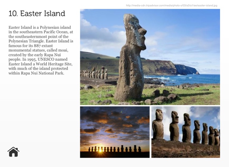
Easter Island is a Polynesian island in the southeastern Pacific Ocean, at the southeasternmost point of the Polynesian Triangle. Easter Island is famous for its 887 extant monumental statues, called moai, created by the early Rapa Nui people. In 1995, UNESCO named Easter Island a World Heritage Site, with much of the island protected within Rapa Nui National Park.
Jeeyoung Jung
Interaction Designer